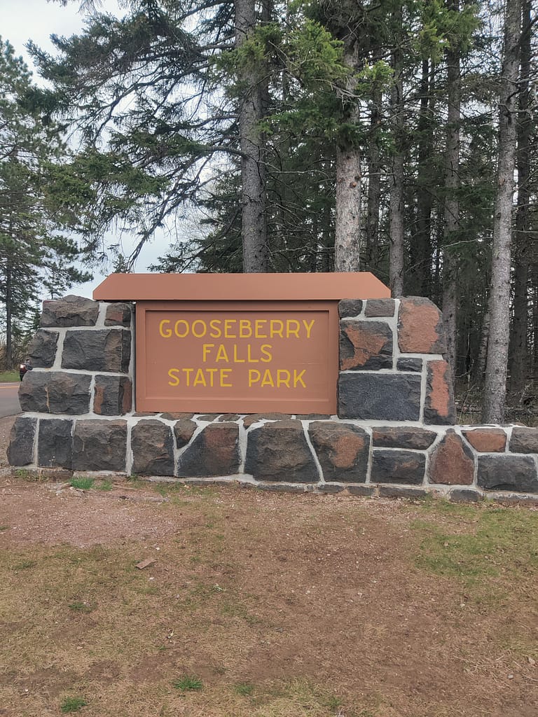
Park Info:
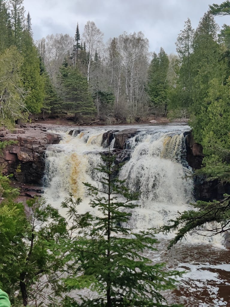
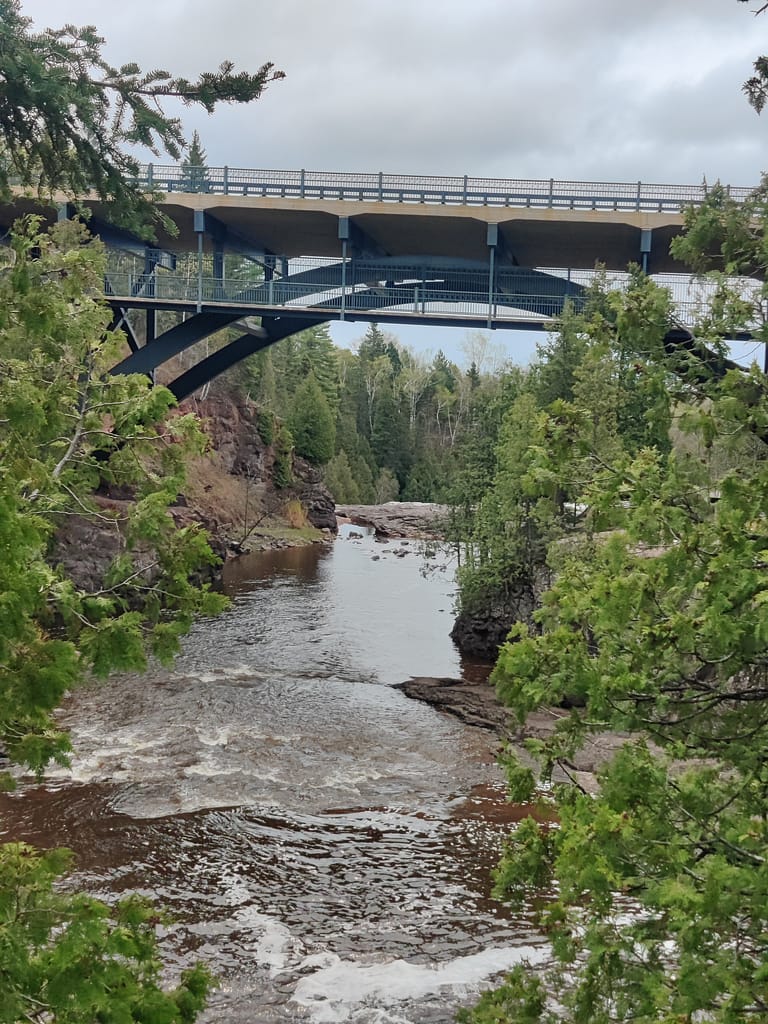
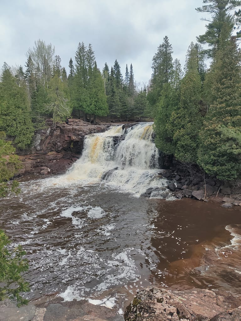
Gooseberry Falls is known for its rocky Lake Superior shoreline, spectacular waterfalls (5 of them!), river gorge, Agate Beach, and north woods wildlife. You can listen to the thunderous roar of the Upper, Middle and Lower Falls of the Gooseberry River as it plummets through a rocky gorge and watch for waves, ships, or the moon rise on Lake Superior from an ancient lava flow known as the Picnic Flow.
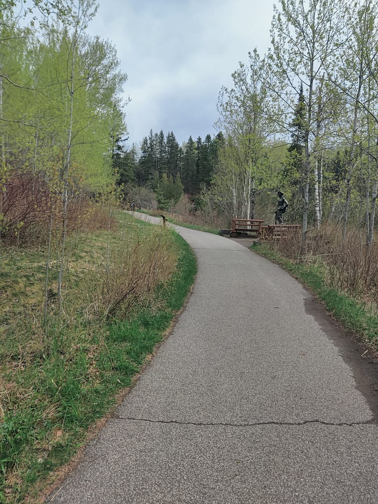
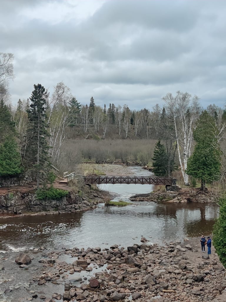
If hiking or skiing is your jam, you can venture out to see the Fifth Falls through a forest of evergreens, aspen, and birch, and enjoy camping in modern campsites, picnicking, and relaxing along the Lake Superior shoreline or the Gooseberry River.
If you are into bird watching, you’re in luck. There are over 225 species of birds that inhabit or visit the park, which include a variety of conifer-dependent birds, ravens, and the herring gulls that establish nesting colonies along the lakeshore. Since Gooseberry is on the North Shore flyway, migratory birds can be seen in the fall and spring months. Several species of mammals, reptiles, and amphibians also inhabit here, including white-tailed deer, black bears, gray wolves, pine martens, and migratory Lake Superior salmon and trout.
There is so much to see and learn about this amazing park, so please check out the website and check out the visitor center when you go!
All of this info came from the Minnesota Department of Natural Resources website, so credit where credit is due. Click here to view the original source.

Accessibility of facility
- The parking situation was accessible, paved, and well-maintained. There are several handicap spots available for those who need them. The front lots are a short walk to the visitor center.
- The bathrooms are located in the visitor center. They are modern and have handicap accessible facilities available in and near the stalled bathrooms, depending on how much space one needs.
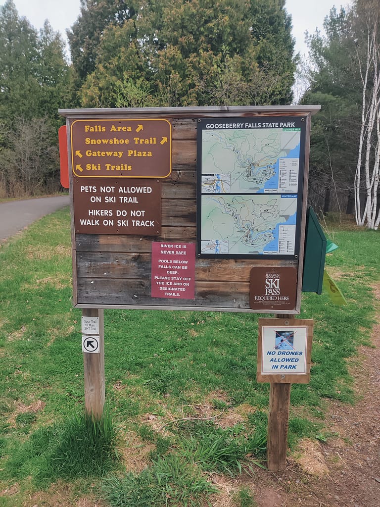
- Getting to the trails is straight-forward. The area is paved and a map is located at the trailhead, so you can choose the route you’d like to go.
Trails
If you’re like me and struggle to read a map (I can tell if we’re headed in the right direction and that’s about it…), AllTrails is a good option. It has navigation and works offline if you download the maps. Don’t be like me and forget to download them and be out of cell service…I downloaded it from the GooglePlay store and signed up for an annual membership. I’m not sure of the current cost, but I got it during a sale and it was around $14 for the year. It was worth it for me because I could see the elevation, terrain type, etc. and made planning easier.
My hiking buddy and I didn’t do the trail I had originally planned, however, we got to see most of what we wanted. The goal was to see the falls and our route brought us to the upper and middle falls. The trail was paved the entire way, but can be uneven in spots. There are both stair and ramp options with benches along the way for resting. To get to the lower falls, stairs were needed and I those weren’t something I could manage that morning.
On my rating scale of easy to hard, which you can find here if you haven’t seen it already, this trail would be easy to moderate. There is incline, which I struggle with, but the stopping points to rest were helpful and when it evened out, my huffing and puffing stopped.
Be safe out there! If you have stuff to say, comment below :) REMEMBER YOUR MAPS AND PASSPORT STAMPS!! Seeyalaterbye <3