Park Info
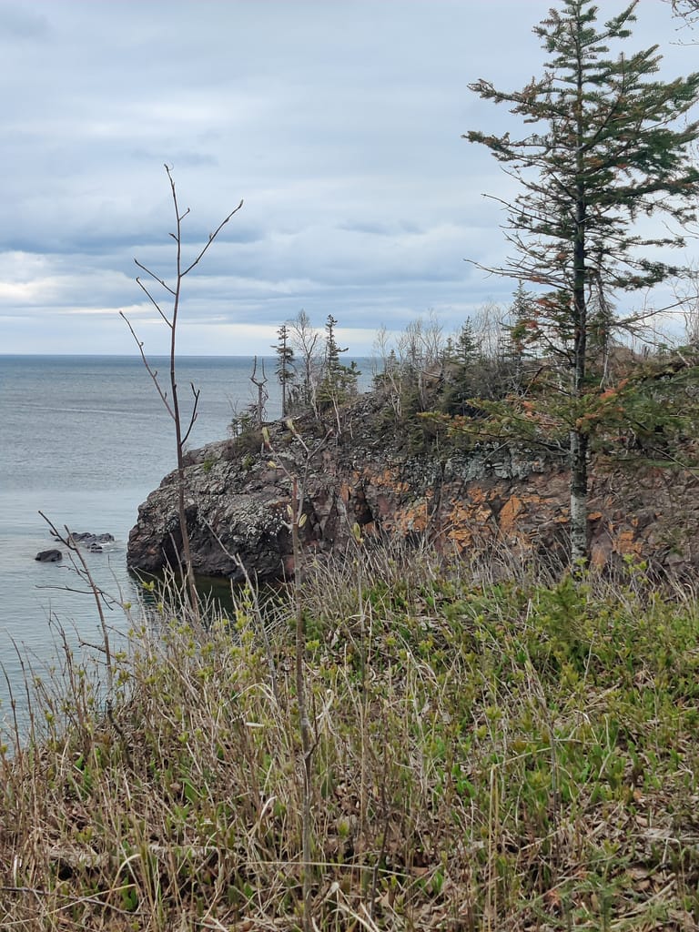
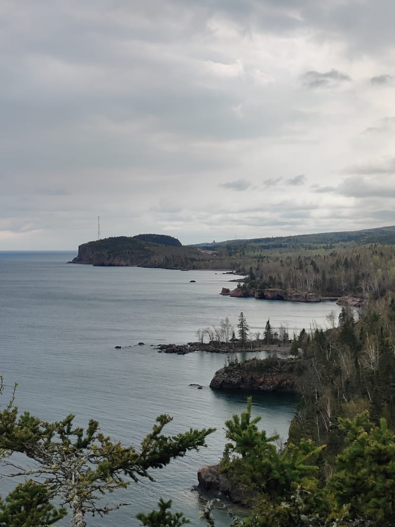
Tettegouche (Te-te-gooch) is beautiful. It offers the overlooks at Shovel Point; rocky, steep cliffs and inland bluffs; the High Falls of the Baptism River (60 foot high water fall people!); and the historic Tettegouche Camp where visitors can stay the night. Hikers love this place because there are miles of trails that overlook the Sawtooth Mountains and wind down to inland lakes accessible only on foot. There are also opportunities for rock climbing, fishing, and bird watching. As for swimming and cliff jumping, don’t. It is posted for a reason….
Speaking of bird watching….in this area 140 different species have been identified, including kinglets, spruce grouse, and many northern warblers nest in bogs and coniferous forests in the summer; hawk migrations in the fall produce numbers in the tens of thousands; and in winter, northern owls, woodpeckers, finches, and winter ducks.
When it comes to mammals, typically there are white-tailed deer, snowshoe hare, red squirrel, and beaver. Less commonly observed are moose, black bear, red fox, and river otter. On occasion, coyote, fisher pine marten, northern flying squirrel, and timber wolves are seen. If you see any of the less common animals while you’re out there, shout them out! Post a pic below if you were lucky enough to catch them. Not going to lie, I’m usually too slow
There is so much to see and learn about this amazing park, so please check out the website linked below and check out the visitor center when you go!
All of this info came from the Minnesota Department of Natural Resources website, so credit where credit is due. Click here to view the original source.
Accessibility
- Parking was accessible, with both handicap and lots of standard spots for both autos and trucks/trailers. The lot is paved and well-maintained and has easy access to the visitor center and bathrooms.
- The bathrooms are located in the visitor center and are modern and accessible.
- Getting to the trail we did was easy once we got our heading on the map. It started right behind the visitor center, so we left from there.
Trail Info
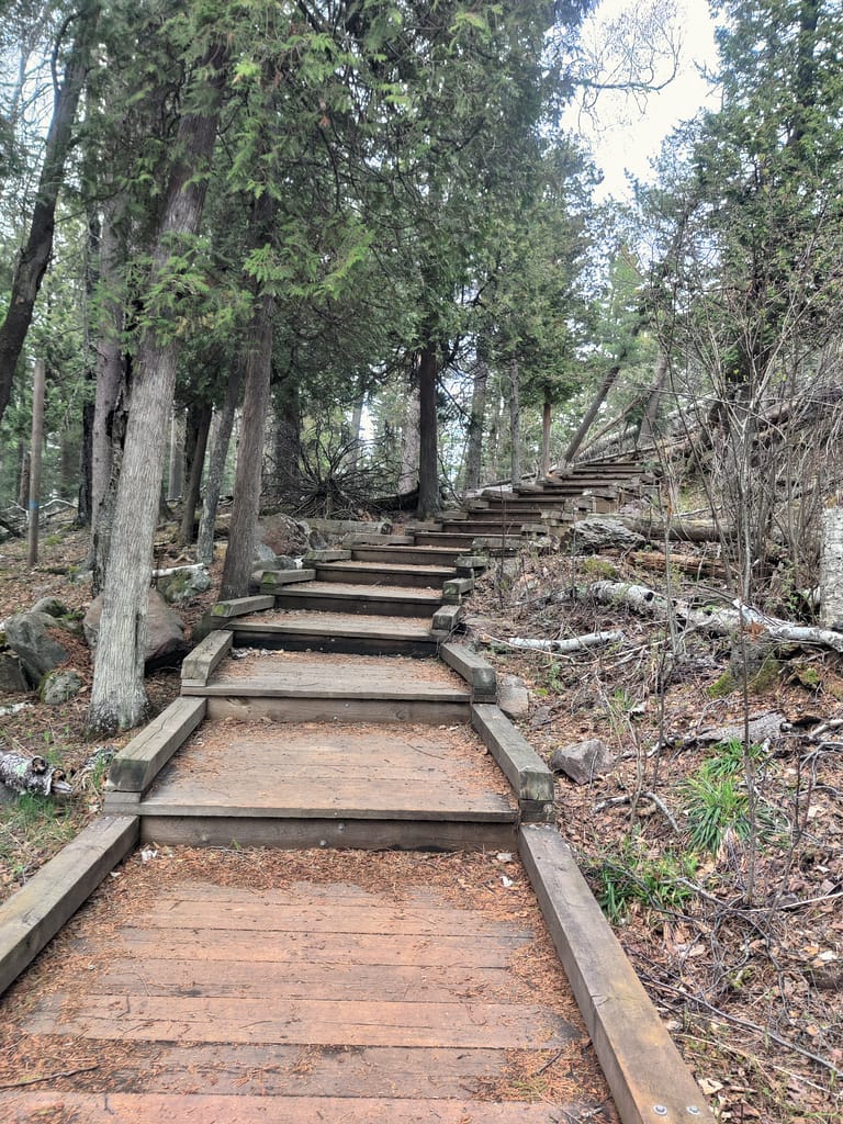
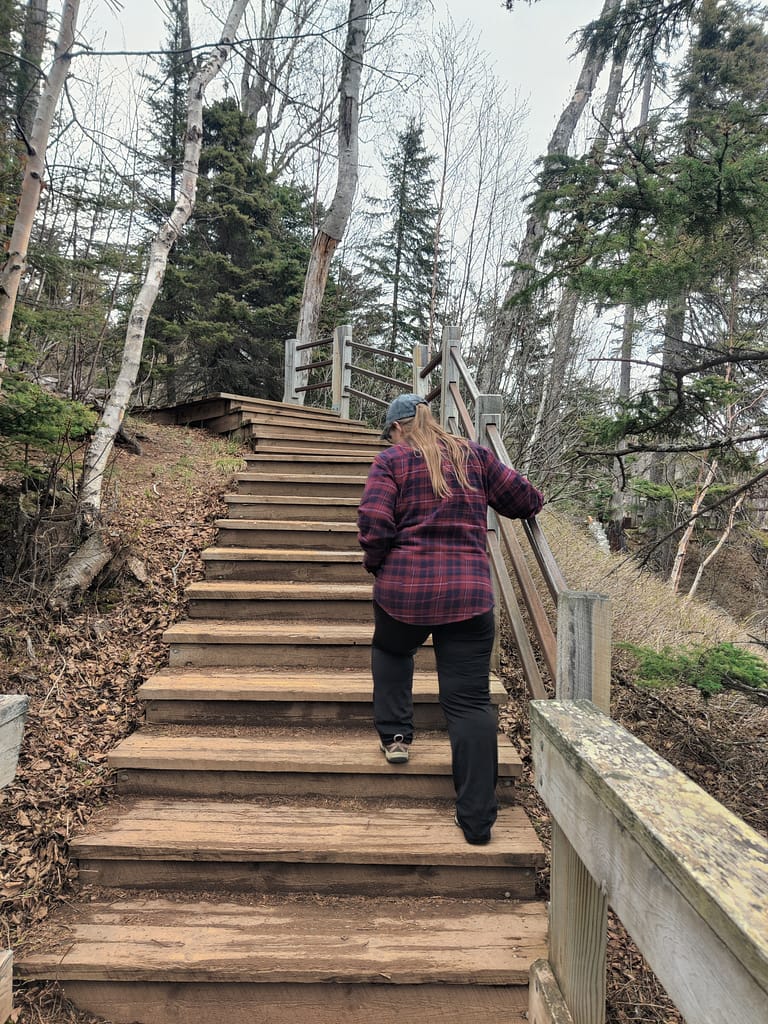
The trail we chose was Shovel Point, since it was labeled as easy in AllTrails. This trail…when I tell you it had so many stairs!!!! Those were not disclosed in the descriptions I read, so it was a surprise to me. I had to stop several times to catch my breath and definitely said some colorful phrases in my head…and maybe out loud.
The trail itself was a standard dirt trail when there weren’t stairs. It is about 1.20 miles out and back, with an elevation of 246 feet (which should have been my first clue for the stairs debacle). It is well-maintained and for those without mobility issues, it wouldn’t be too bad. There were a couple benches along the way at lookout points, but that was it for rest areas. It was worth doing and seeing for me and my hiking buddy, just keep in mind, it will be a workout if you’re like me.
On my rating scale, this one would fall into the moderate to hard category, because of those darn stairs and incline. My hiking buddy found it to be easy to moderate. They don’t have breathing issues like I do, so there’s another perspective to take into consideration.
Be safe out there! If you have stuff to say, comment below :) REMEMBER YOUR MAPS AND PASSPORT STAMPS!! Seeyalaterbye <3